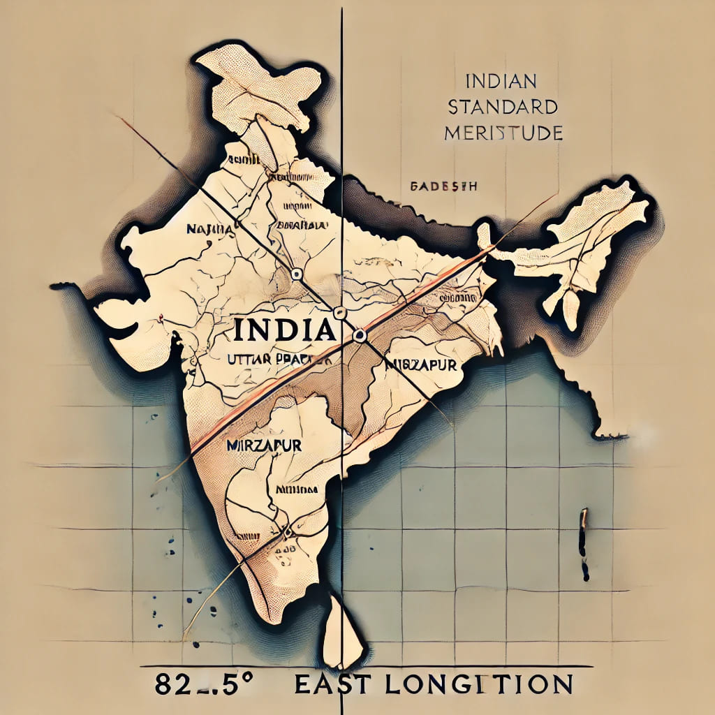
You can find various virtual lines on Globe, these are apparent in nature. These lines are man made in nature and only appear on Globe not on Earth. One of such lines (Longitude) is 82 30 passing through India. So, here we are going to find why 82 30 is selected as Standard Meridian.
Latitude and Longitude
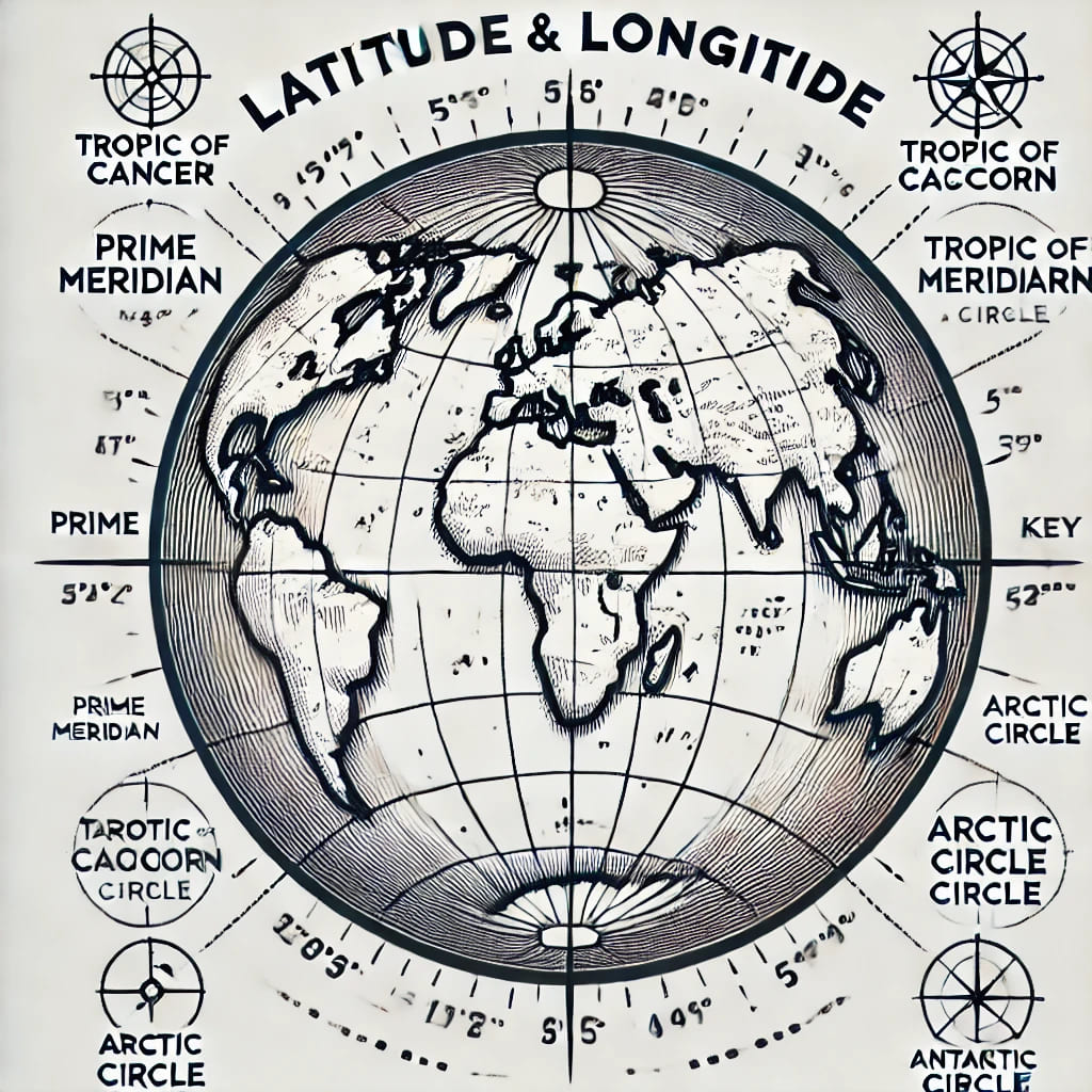
If we take reference of the equator then parallel lines to equator are Latitude and perpendicular lines to equator are Longitude. Here, equator is a line or a plan which divides the Globe into two hemispheres, Southern Hemisphere and Northern Hemisphere.
Read about Uses of Maps
Latitude
As we know these are perpendicular lines to the equator. The range of latitude is from Zero to 90 and the unit is Degree. The Equator is considered as 0° and both Poles are considered as 90°. The south and north are added as suffixes to the latitudes to locate the position either on north or in south.
Longitude
In 1884, a Conference was held in Washington D.C. to decide the Prime Meridian. As a result of this conference, Royal Observatory, Greenwich (Britain) is elected as a reference point for the prime meridian.
In case of latitude we have the reference point as the Equator but in case of Longitude there was no reference point. So, in Washington D.C., the World Leaders decided the Greenwich Meridian as a prime meridian.
The range of latitude is from zero to 180 and the unit is Degree. As we know these lines are perpendicular to equator, but the reference point is Greenwich meridian. On the globe for the left side of the prime meridian we use suffixes east and for the right side we use west.
Greenwich meridian is considered as 0° longitude and 180° longitude of both east and west coincide on each other. This coincided line is considered as the International Date Line. Although due to land and water on 180° the Washington Conference had drawn an imaginary Date line which is not exactly at 180°.
These angles of Latitudes are measured at the pole with the reference line as prime meridian, on the other hand the angles of Latitude are measured by dividing the distance from equator to pole by 90 and the unit distance is considered as 1°.
Time and the Meridians
The Equator looks like a perfect circle, it means it is 360°. It can also be seen through numbers of degrees of longitudes 180° East and 180° West. Sum total of both is 360°.
Earth completes its one rotation on its axis in 24 hours. If we divide 360 by 24 then we will get how much difference of degrees there is in the time difference of 1 hour.
After division we get 15. It means on Earth if we move 15° longitudinally then we have to set our watches 1 hour forward or backward. If we move towards east then we have to set time ahead and if we move towards west then we have to set the time behind.
Apparently it is like if we move eastward we enter the future and if we move west then we are entering the past.
Why 82 30 is selected as Standard Meridian
We know how time is calculated on any point on the earth. Now we are going to understand
why 82 30 is selected as Standard Meridian.
There are two factors which define Standard Meridian of any country.
Relation With Prime Meridian
It is the Global factor, why 82 30 is selected as Standard Meridian.
On earth 1 hour difference is equal to 15°, so 30 minutes equals 7.5° (7 degrees and 30 minutes). Any country of earth decides its standard meridian in the multiple of 7.5° it means the difference of time will be in multiple of ½ hours.
If we divide India’s Standard Meridian 82° 30’ (82.5°) with 7.5 then the answer will be 11. It means 11 times ½ hour. Which is equal to 5 hours and 30 minutes. So, India’s time is 5:30 hours ahead of Greenwich time because India is in the East to prime meridian.
Local Factors
There are various local factors why 82 30 is selected as Standard Meridian. These can be Size of the Country, knowledge of people etc. There are various countries having multiple standard time and there are various countries whose standard meridian doesn’t pass through their area.
Longitudinal extension of Indian territory is from 68° 7’ E to 97° 25’ E, which is approximately 30°. It means eastern and western ends of India have 2 hours of time difference.
At the time of adoption of standard meridian the literacy rate of India was very low. So, we chose 82.5° as the standard meridian for India. This comes approximately into the middle of both the ends.
Conclusion
There are various issues with the standard meridian of India like:-
- North eastern states face one hour early sunrises and sunsets.
- Western states face one hour late sunrises and sunsets.
- North eastern states are demanding Daylight saving systems to be installed in official works.
- Some are suggesting two time zones for india.
If we use any of such methods then administration will become quite tough. And it will not be that easy for people to adopt these methods.